v.5.0 is out Now!
Get Started
Products
by Category
Flight Planning & Control
Automated drone mission planning and flight control
Integrated Systems
Various sensors integrated with drones, ensured by SkyHub hardware and UgCS software
Drone Show Technologies
Drone light shows for Entertainment & Advertisement
Data Processing
Solutions for image, point cloud, geophysical data processing and delivering essential technologies to facilitate your drone-based business
by Application
Mining
Construction
Photogrammetry
LiDAR surveys
Vertical inspections
Geotagged video surveying
Bathymetry
Sensor Testing Range
Academic research
Test counter-drone system
by Technology
Flight planning software
SkyHub
True Terrain Following
Magnetometers
GPR
Echo sounder
Metal detection
Methane detection
Water sampling
Multi drone operations
Top Products
Support
Downloads
Flight Planning & Control
UgCS
UgCS Commander
UgCS Mapper
Integrated Systems
SkyHub
CPM
GeoHammer
GeoTagger
Data Processing & Reporting
DroneGIS
ImageInspector
Software for Sensor data Processing
Partners
Official Resellers
Find a Reseller
Educational Program
Educational Partners
Academic Research
Partnerships
Become a Partner
Resources
Blog
Insights
Success Stories
Upcoming Events
Guides
How To / Articles
Webinars
Case Studies
Learn UgCS
UgCS Manuals
UgCS supported drones
Newsroom
PR / New
Updates
Trainings
Featured
Contact Us
Contact Us
Shop
Data Processing & Custom Development
DroneGIS Data Samples
DroneGIS project gallery
AI
Agriculture
Architecture
Bathymetry
Construction
Echosounder
Energy
Environmental engineering
Geophysics
Lidar
Magnetometer
Methane detector
Mining
Photogrammetry
Powerlines
Roads/Transportation
Satellite images
Solar panels
Thermal
Reset
Graphisoft Archicad building model combined with the map
Architecture
Construction
View in DroneGIS
Turaida Castle large scale point cloud
Architecture
Photogrammetry
View in DroneGIS
Bathymetry data combined with the photogrammetry Point Cloud
Echosounder
Lidar
Bathymetry
View in DroneGIS
Falcon 2 Methane data
Methane detector
Environmental engineering
View in DroneGIS
Methane data combined with Point Cloud
Methane detector
Lidar
Environmental engineering
View in DroneGIS
Localization of solar panel photovoltaic panel failures on a roof installation
Solar panels
Thermal
View in DroneGIS
Automatic yang pineapple counting
Agriculture
AI
View in DroneGIS
LiAir250 LIDAR data. Powerline corridor inspection. Data courtesy of Greenvalley Int. Classified in LiPowerlines software, then uploaded to DroneGIS (prev.ATLAS)
Energy
Powerlines
Lidar
View in DroneGIS
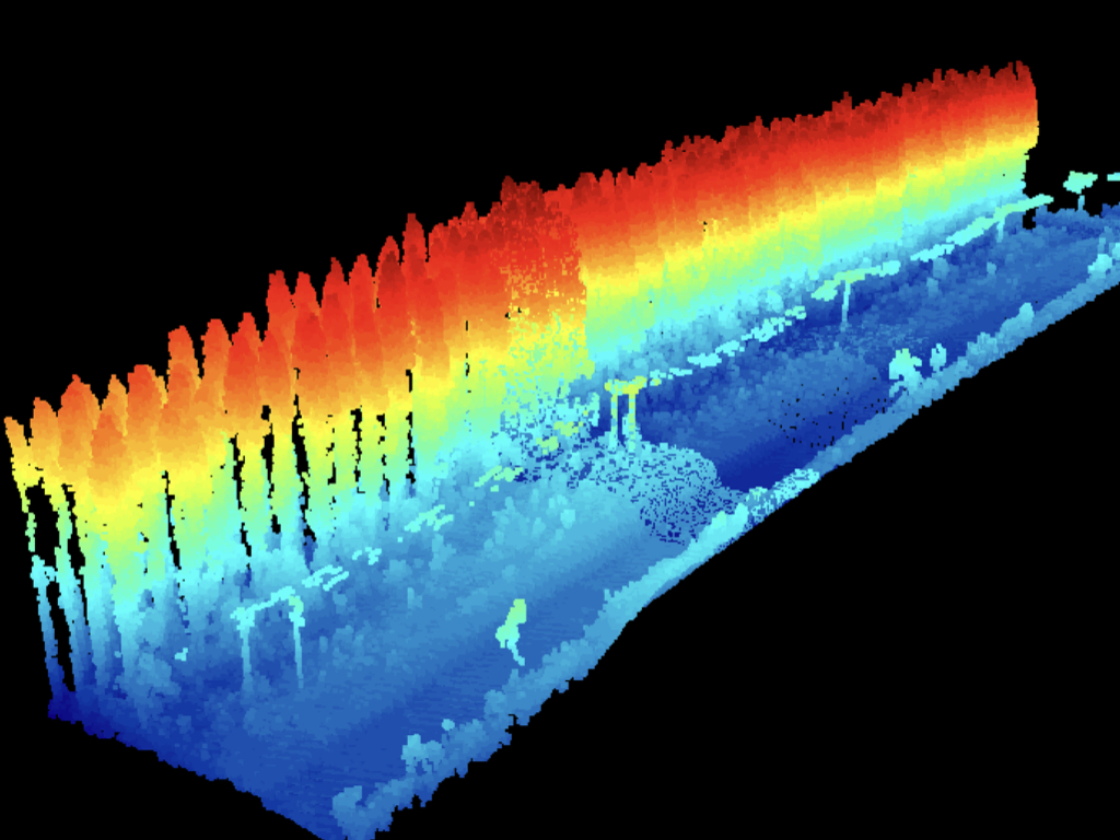
YellowScan Mapper point cloud colorized by height
Mining
Construction
Lidar
View in DroneGIS
Dataset is gathered using QuSpin Gen-2 sensor. Data was processed using Geosoft Inc. Oasis Montaj and published to DroneGIS (prev.ATLAS)
Mining
Geophysics
Magnetometer
View in DroneGIS
Data from quarry processed with Pix4D Engine SDK and Atlas Rock Fragmentation AI
Mining
AI
View in DroneGIS
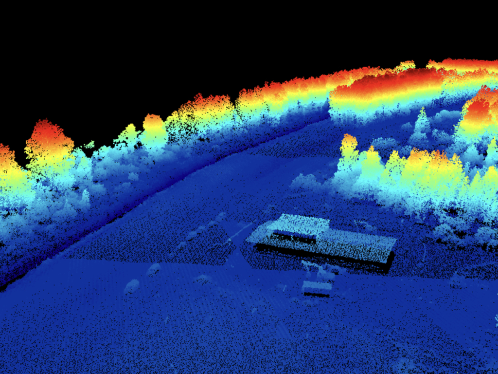
DJI L1 sample data of the SPH Office
Construction
Architecture
Lidar
View in DroneGIS
Detecting abandoned crab pots on the sea floor on the synthesized orthomosaics of the echosounder data. Map courtesy of the University of Dalaware
Bathymetry
Echosounder
AI
View in DroneGIS
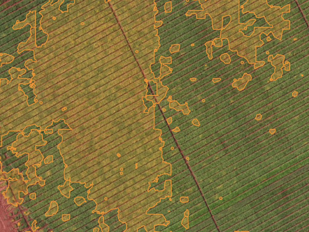
Detecting areas affected by field dodder weed on a sugar beet plantation
Agriculture
AI
View in DroneGIS
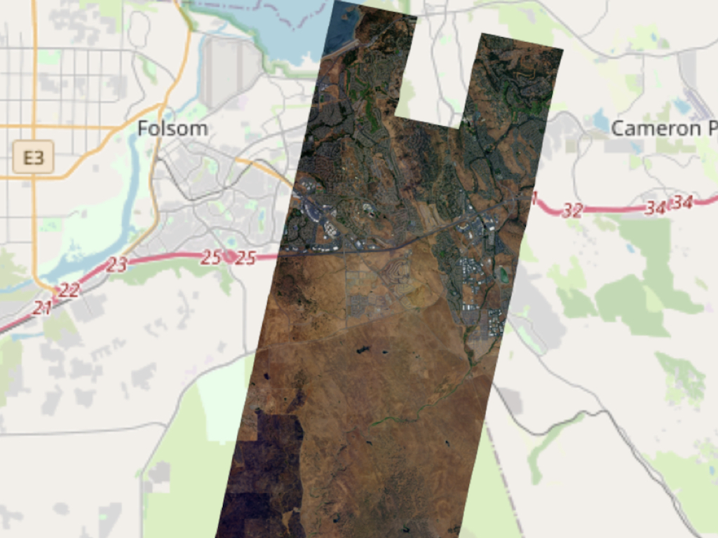
Visualizing large scale satellite images. Satellite image courtesy of Planet.com
Construction
Roads/Transportation
Satellite images
View in DroneGIS
Geoingeneria Mexico - Road quality AI detection / Mexico
Roads/Transportation
Architecture
Photogrammetry
View in DroneGIS
Visualization of a B3DM model of DJI Terra
Construction
Architecture
Photogrammetry
View in DroneGIS